
(From F. Brinkley and Baron Kikuchi, A History of the Japanese People from the Earliest Times to the End of the Meiji Era, New York-London, The Encyclopaedia Britannica, 1915)
This page presents maps illustrating Japan’s territorial organization, regional structures, and early foreign contacts. Designed for instructional use, the atlas reflects early 20th‑century approaches to presenting Japanese historical geography.
See also :
M. L. W. Laistner, A Survey of Ancient History to the Death of Constantine, Boston, D.C. Heath & Co., 1929;
A. W. Ward et al., The Cambridge Modern History Atlas, Cambridge, Cambridge University Press, 1924;
James Westfall Thompson, Ancient History of the Middle Ages: 300-1500, New York, W.W. Norton, 1937;
George Adam Smith, An Atlas of the Historical Geography of the Holy Land, London, Hodder and Stoughton, 1915;
Albert Bushnell Hart & alii, eds., American History Atlas, Third Edition, Chicago, Denoyer-Geppert Co., 1930;
Townsend Mac Coun, An Historical Geography of the United States, New York-Boston-Chicago, Silver, Burdett & Co., 1901;
Dixon Ryan Fox, Harper’s Atlas of American History, New York, Harper and Brothers Publishers, 1920;
Lawrence J. Burpee, ed., An Historical Atlas of Canada, Toronto, Thomas Nelson & Sons, 1927;
J. G. Bartholomew, Atlas for Canadian Schools: A New Series of Physical and Political Maps, London, Thomas Nelson & Sons, 1913;
Clifford Sifton, Concise School Atlas of the Dominion of Canada, Ottawa, Minister of Interior, 1900;
Emil Reich, A New Student Atlas of English History, London, Macmillan and co., 1903;
T. W. Higginson, E. Channing, English History for Americans, New York, Longmans, Green & Co., 1902;
R. F. Treharne, H. Fullard, Muir's New School Atlas of Universal History, London, George Philip & Son Ltd., 1928;
Léon Mirot, Manuel de géographie historique de la France, Paris, Éditions A et J. Picard, 1947;
James Murdoch and Ysoh Yamagata, A History of Japan during the Century of Early Foreign Intercourse 1542-1651, Kobe, The Chronicle, 1903.
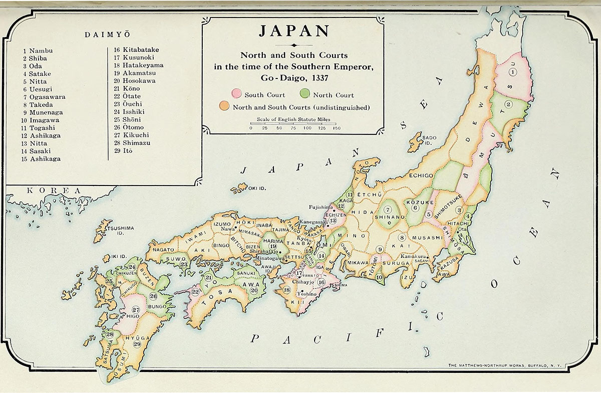
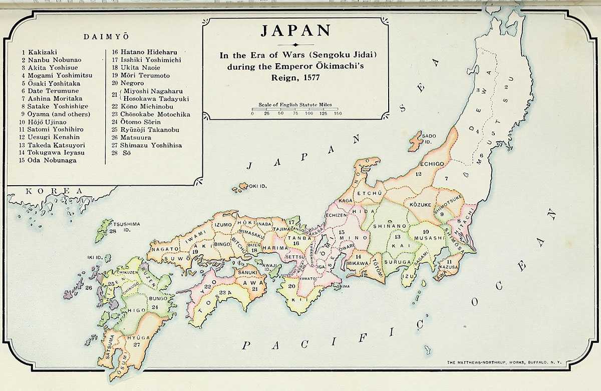
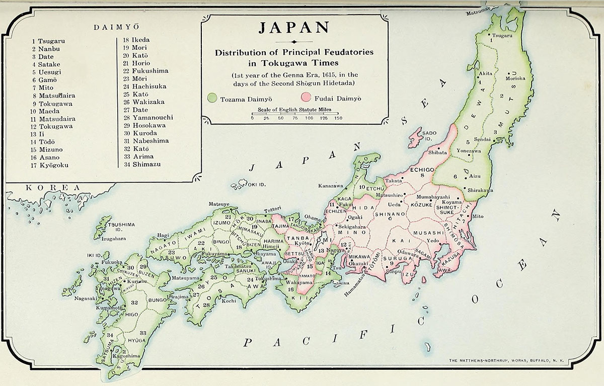
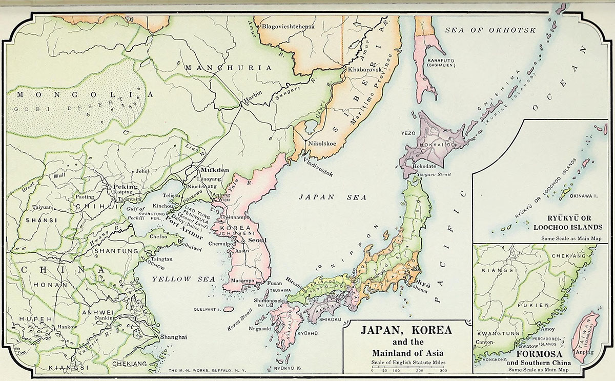
Sources, Methodology & Educational Use: The maps on this page are reproduced from an early 20th‑century historical textbook used in classroom instruction. Prepared for educational use, the textbook reflects the pedagogical standards and geographic knowledge of its time. Each map has been reviewed with attention to its publication context, edition, and educational purpose, following established practices in historical cartography and the study of school materials. The selection is curated to support teaching and research on historical geography and the visual conventions of early 20th‑century educational resources.
edmaps.com — Historical Cartography for Education
edmaps.com provides original maps and curated historical maps designed to support teaching, learning, and public understanding of history and historical geography. The original maps are created by Dr. Cristian Ionita, and all curated maps are selected from public archives, historical collections, and private holdings, and are presented for educational and non‑commercial use.
© Cristian Ionita. All rights reserved.
Website: https://edmaps.com — Contact: info@edmaps.com
